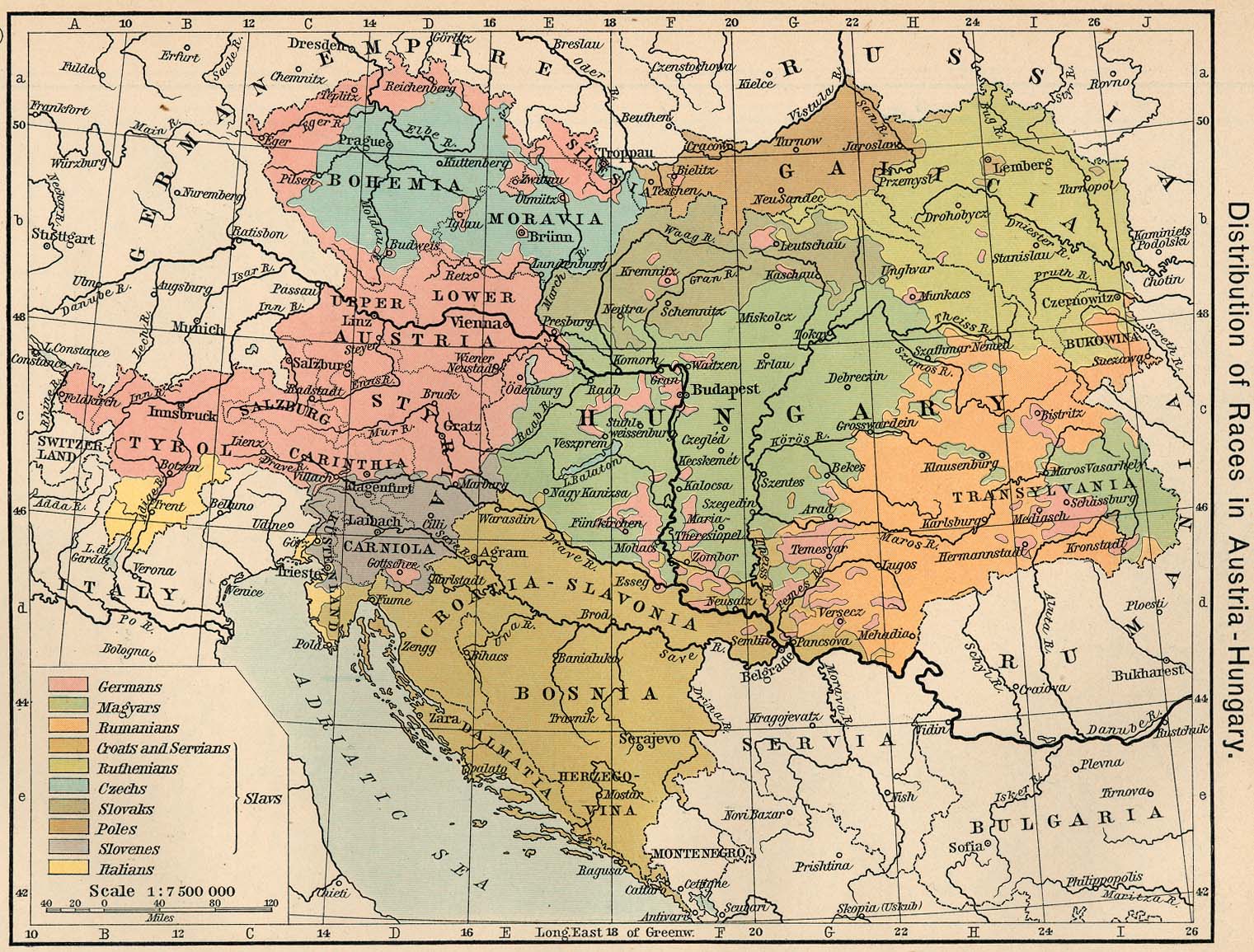
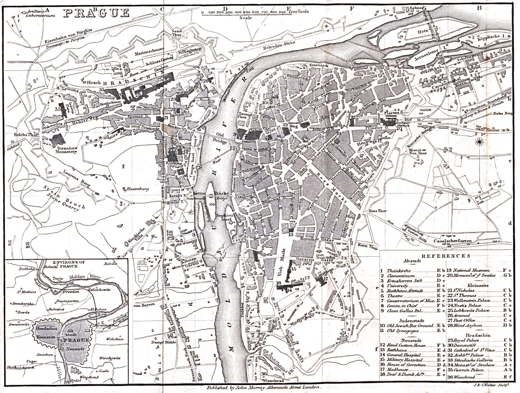
Here is an ethnic map of Austro-Hungary in 1911. And here's a map of Prague in 1858. Sorry for my shoddy German, but is that an ostrich garden behind where the National Museum now stands?
Lately I've been spending some time at the beautiful old reading room of Charles University's Klementinum library, which has an excellent browsing section. In particular I've been flipping through The Times Guide to the Peoples of Europe, an amazing little volume. Here I was thinking I was pretty well versed on Europe's more obscure nations -- hell, I once went out of my way to visit the Sorb Museum in Cottbus. But no. I was not even aware, for instance, of the existence of the Lemkos of Galcia. And that's just a start!
Meanwhile, here's a interactive langauge map of the United States that's just too cool for words. And no, it's not color-coded map of whether people say "coke," "soda" or "pop." This one is about actual languages, as in, "Gee, I wonder which county contains the most Gajarathi speakers?"
Actually, now that I've played with it for a few minutes, it's a bit disappointing. Since the map deals with absolute numbers rather than concentrations, the answer to most questions like these turns out to be Los Angeles.
posted by Scott at 1:30 AM
![]()
![]()
<-- use as a back-up

3 Comments:
louis vuitton handbags
true religion jeans
coach factory outlet
gucci outlet
lebron 11
kobe 11
michael kors handbags
oakley sunglasses wholesale
jordan concords
abercrombie outlet
louis vuitton outlet
louis vuitton outlet
toms outlet
michael kors outlet online
timberlands
louis vuitton outlet stores
mulberry uk
chanel bags
supra shoes
hollister clothing
north face jackets
louis vuitton
christian louboutin outlet
michael kors uk
true religion outlet
nike huarache shoes
ugg sale
nike air max
polo outlet
nike trainers uk
christian louboutin shoes
ugg sale
2016202yuanyuan
0615jejecanada goose jackets
coach factory outlet
pandora
red bottom shoes
moncler outlet
jordan shoes
canada goose jackets
dsquared
pandora jewelry outlet
canada goose uk
ugg boots on sale 70% off
off white outlet
nike requin pas cher
pandora charms outlet
christian louboutin shoes
hermes belt
true religion outlet store
ugg boots on sale 70% off
nike shoes
saics running shoes
wqr0w822tryr
Post a Comment
<< Home